The Launch of Copernicus Sentinel-1C
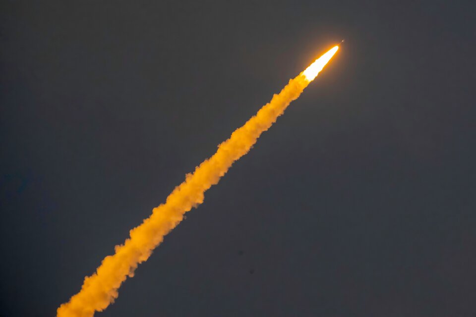
The Copernicus Sentinel-1C satellite was successfully launched from Europe’s spaceport in Kourou, French Guiana, on 5 December 2024. As the sole radar satellite mission delivering data on a free and fully open basis, the Copernicus Sentinel-1 mission plays a key role in supporting a variety of sectors globally, including agriculture, transportation, emergency response, hazard management, and infrastructure monitoring.
Sentinel-1C now joins the Sentinel-1A satellite in orbit, replacing the retired Sentinel-1B, and continues the mission’s legacy of providing valuable Synthetic Aperture Radar (SAR) data to users worldwide. What benefits does this launch bring to the Philippines?

The role of the CopPhil initiative in promoting the uptake of Copernicus Sentinel-1 data in the Philippines
The EU has been supporting the Philippine Space Agency and the Department of Science and Technology to build the CopPhil Infrastructure, which provides access to large datasets of Copernicus Sentinel satellite data in a controlled cloud environment and on a free and open basis for all users in the Philippines. This unique initiative is the first Copernicus infrastructure in Asia, and a flagship programme of the EU’s Global Gateway strategy.
Among the activities of CopPhil is the development of Copernicus Earth Observation-based pilot services, many of which leverage data from the Sentinel-1 mission. The pilot services fall under three thematic areas:
- Ground Motion Monitoring
- Land Cover, Forest & Crop Mapping
- Coastal Marine (benthic) Habitat Monitoring
The Ground Motion Monitoring Service will allow for the processing of historical SAR data from Copernicus Sentinel-1 to better track the Earth’s surface movements caused by seismic activity, volcanic eruptions, tectonic shifts, landslides, and human activities. The addition of Sentinel-1C will significantly improve the temporal resolution of the Copernicus Sentinel-1 mission, thereby boosting the service’s ability to produce more accurate products and increase monitoring capabilities.
Additionally, Copernicus Sentinel-1 imagery and SAR data play a key role in the Land Cover, Forest, and Crop Mapping Service. With the successful launch of Sentinel-1C, an expanded data set will further facilitate the development of time series products, enabling more precise mapping of crop layers, tree and forest layers, and other land cover types.
The services will support Filipino authorities in analysing environmental trends and increasing their readiness to provide support to citizens during extreme weather events. Within the CopPhil initiative, training and online courses on how to leverage Sentinel-1 data to foster user uptake in the Philippines will also be provided.
Applications of Copernicus Sentinel-1 in the Philippines
The Copernicus Sentinel-1 mission has a wide range of applications on both land and at sea. With the addition of Sentinel-1C, the mission’s nominal temporal resolution will improve the monitoring of land changes, providing valuable insights for urban planning, agriculture, and forest management. For example, the mission supports the use of Differential Synthetic Aperture Radar Interferometry (DInSAR) to track even the smallest ground movements, improving the understanding of earthquakes, landslides, volcanic activity, and other ground deformation events.

When it comes to the sea, the Copernicus Sentinel-1 mission has applications in maritime transportation, whereby radar technology is used to detect ships, including small fishing boats and vessels. Additionally, Sentinel-1 radar imagery helps oceanographic studies by providing data on wind and wave conditions. This information is valuable for weather forecasting, optimising ship fuel consumption, supporting the development of marine renewable energy installations, and fostering the understanding of ocean circulation patterns. The radar’s ability to monitor ocean surface features helps create accurate models of wave heights and wind speeds, while also helping to detect both accidental and intentional oil spills.

Finally, the Copernicus Sentinel-1 mission plays an essential role in disaster risk reduction in the Philippines. Its SAR-equipped satellites acquire data in all weather conditions and during the night, facilitating the creation of mapping products for flood monitoring and supporting emergency response operations.
Background Information
As a flagship and unique programme of the EU’s Global Gateway strategy, CopPhil is designed to harness digital resources and space technology for sustainable development and to support innovations in research and business in close cooperation with government partners.
CopPhil is managed by the European Union Delegation to the Philippines. It is implemented by the European Space Agency (ESA) in partnership with the Philippine Space Agency (PhilSA) and the Philippine Department of Science and Technology (DOST).


