2024 has been a year of growth, collaboration, and notable accomplishments for CopPhil. Through partnership building with key stakeholders and the progress in the development of key components of the initiative, we have achieved significant breakthroughs in our mission to promote the uptake of Copernicus Earth Observation data among users in the Philippines.
As a flagship and unique programme of the EU’s Global Gateway strategy, the Centre has successfully engaged with diverse stakeholders, hosted capacity building initiatives, and worked to increase the accessibility of Copernicus data in the country over the past year.
In this article, we reflect on the key milestones, achievements, and successes which have shaped our journey so far, paving the way for an even more impactful year ahead for the CopPhil initiative.
First Light Inaugural Event
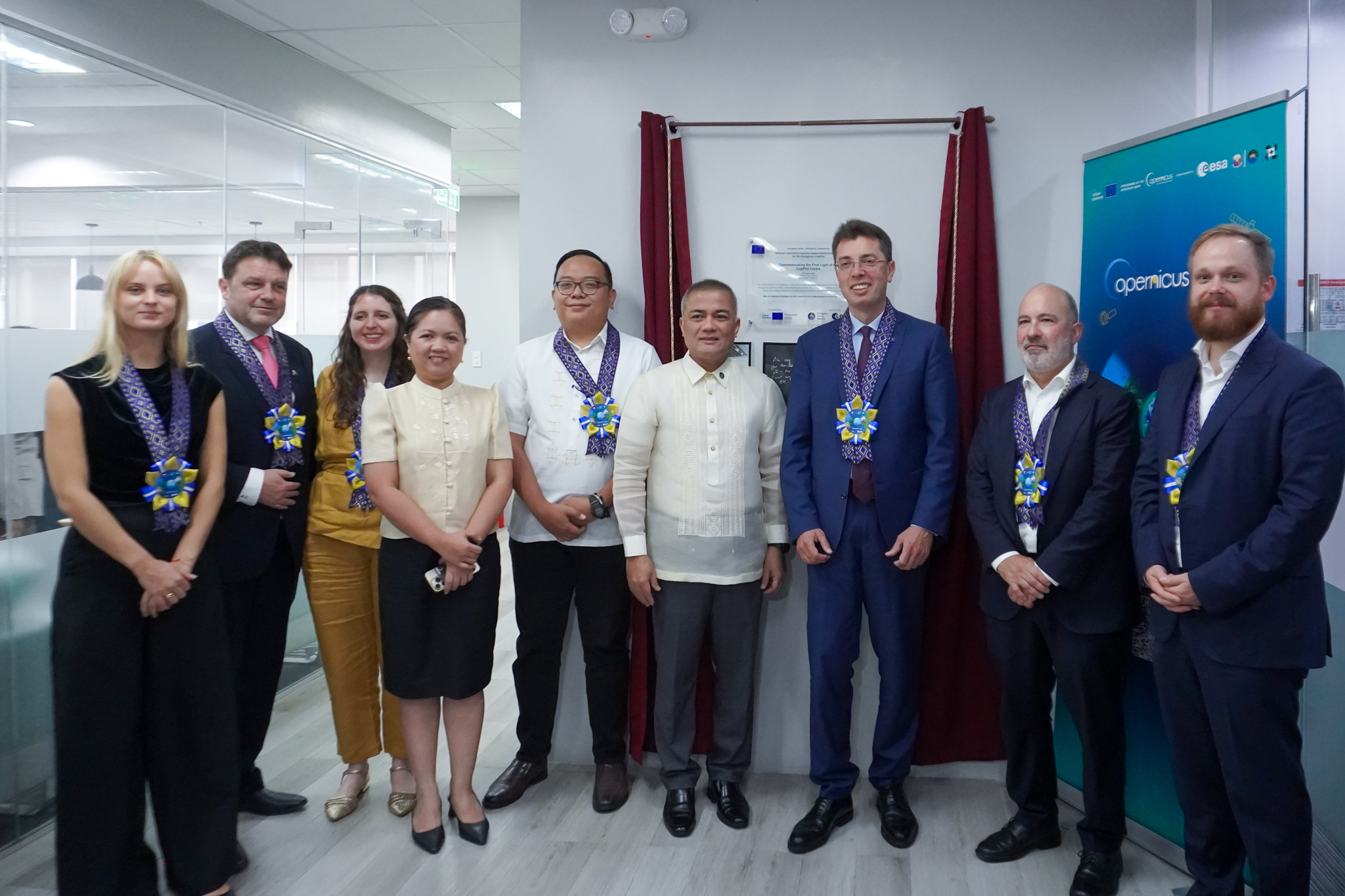
On 17 October, CopPhil hosted its First Light inaugural event in Manila, unveiling the first results of the initiative. The event highlighted CopPhil’s role in providing Earth Observation data to support climate resilience, ecosystem protection, agricultural monitoring, and hazard management in the Philippines. In addition to showcasing the initiative’s IT infrastructure and pilot services under development, the First Light event marked the beginning of a wider effort to boost accessibility of Copernicus Sentinel satellite data and foster knowledge transfer in the Philippines.
The launch of the CopPhil website and social media
This year, the CopPhil website and social media accounts went live, serving as one-stop-shops for all the latest information and updates related to the initiative. Make sure to follow us on LinkedIn and X and check our website regularly to stay up to date!
Launch of the CopPhil IT infrastructure
Among the core activities of CopPhil is the development of an IT infrastructure, comprising an ad hoc cloud environment and a Copernicus Mirror Site. In November 2024, the CopPhil Infrastructure website was officially launched, providing free, open, and immediate access to Copernicus Earth Observation data for users across the Philippines.
Development of the CopPhil Pilot Services
The CopPhil pilot services will leverage Copernicus Earth Observation data to complement existing regional systems. By addressing regional challenges in relation to a changing climate and environmental pressure, they will help to boost benefits for local communities.
Developed in close collaboration with Filipino stakeholders, the services will be handed over to the Philippine Space Agency for continued implementation after a demonstration phase. The services are developed across three thematic areas, including:
- Land Cover, Forest & Crop Monitoring
- Ground Motion Monitoring (GMS)
- Coastal Marine Habitat (Benthic) Monitoring
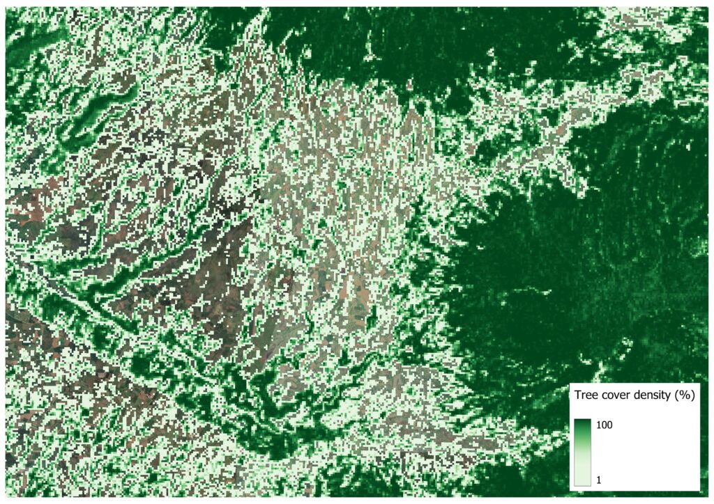
The development of the Forest Monitoring services has seen significant progress in 2024. A consolidated version of the Forest Area and Type and Tree Cover Density products was successfully developed, while the first version of the Forest Cover Change product is nearing completion. Activities are now underway to further improve these products in collaboration with Filipino co-developers, whose feedback will inform the project’s next steps and ensure that they are accurate and useful for local stakeholders.

As for the Crop Mapping service, the algorithms for two products, Crop Extent and Crop Type, are undergoing validation, while for the Land Cover service, progress has been made on the Land Cover Map product and the Land Cover Change Map product. For all of the services, the development is ongoing in close collaboration with local stakeholders.
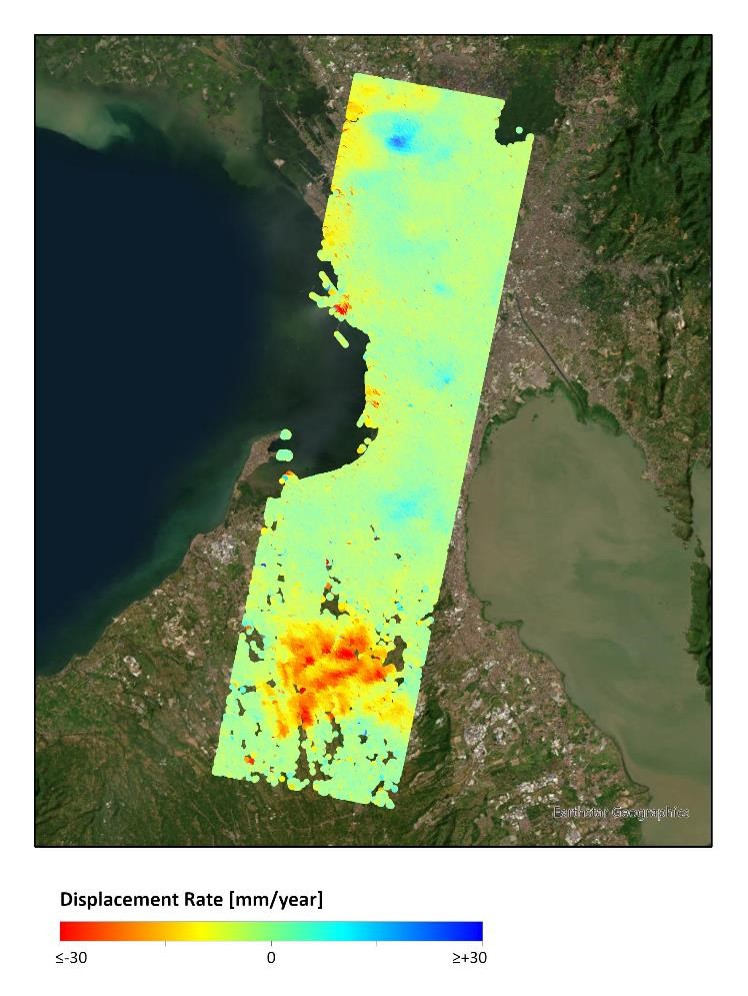
Progress has also been made on the Ground Motion Monitoring Service for which various options for implementing the service’s processing chain have been assessed. An internal validation process was carried out to select the most suitable and reliable combination of open-source tools for generating GMS data. A test processing run was performed over Manila and its surrounding areas, leading to the production of the Line of Sight Basic Product (P1.1) as a proof-of-concept, which is illustrated in the image below. To produce a large-scale product, efforts are underway to stitch together results from adjacent Sentinel-1 radar data tracks, which will be followed by the combination of Ascending P1.1 and Descending P1.1 results to retrieve East-West and Up-Down motion components (P1.3).
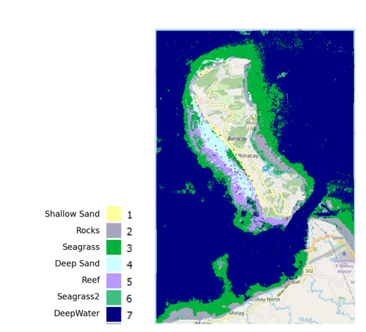
Regarding the Coastal Marine Habitat (Benthic) Monitoring service, progress has been made with the selection of the Areas of Interest in the Philippines, the cataloguing of the available cloud-free Copernicus Sentinel-2 imagery, and the release of the first sample products of the Bathymetry Map and Habitat Map products. The available auxiliary in situ data, which is required for calibration and validation of the satellite-based products, was also catalogued and analysed.
Capacity-Building and Stakeholder Engagement
In 2024, the CopPhil initiative laid the groundwork for upcoming training sessions, stakeholder engagement activities, and events.
In October, CopPhil hosted the Co-Creation Workshop, gathering participants from key Philippine institutions to discuss their needs in terms of Earth Observation data and services in the country.
In November, the first training session of CopPhil took place online, bringing together over 80 participants from 16 institutions which were given the opportunity to develop their knowledge of Earth Observation, Copernicus, and CopPhil.
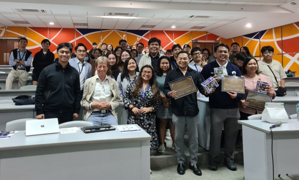
In December, a team of CopPhil and Philippine Space Agency (PhilSA) experts visited students at Ateneo University, discussing how Copernicus data can be used for disaster risk reduction in the Philippines. On a separate occasion, a CopPhil expert team participated in a ‘telemapathon’ organised by the Humanitarian OpenStreetMap Team, highlighting the importance of Earth Observation and mapping for disaster preparedness and response.
Furthermore, CopPhil has announced the EU CopPhil Scholarship Programme, which will provide fully funded opportunities for Filipino government employees to pursue advanced studies in Earth Observation and Remote Sensing. With a focus on climate change, natural resources, and disaster management, the programme aims to boost the use of Copernicus data to benefit governance and policymaking in the Philippines.
These events are the beginning of many more aiming to foster knowledge and skills transfer and further empower users in the Philippines to harness the full potential of Copernicus data.
Participation in Regional Events
Over the past year, CopPhil was featured at several regional events, such as the Philippine Space Week, the Thailand Space Week, and the Philippine Startup Week, where CopPhil representatives increased the visibility of the initiative and garnered interest among key stakeholders.
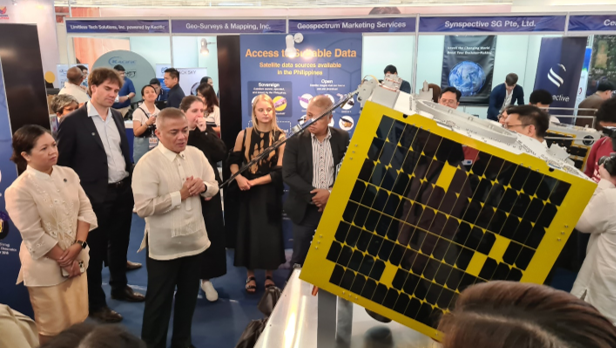
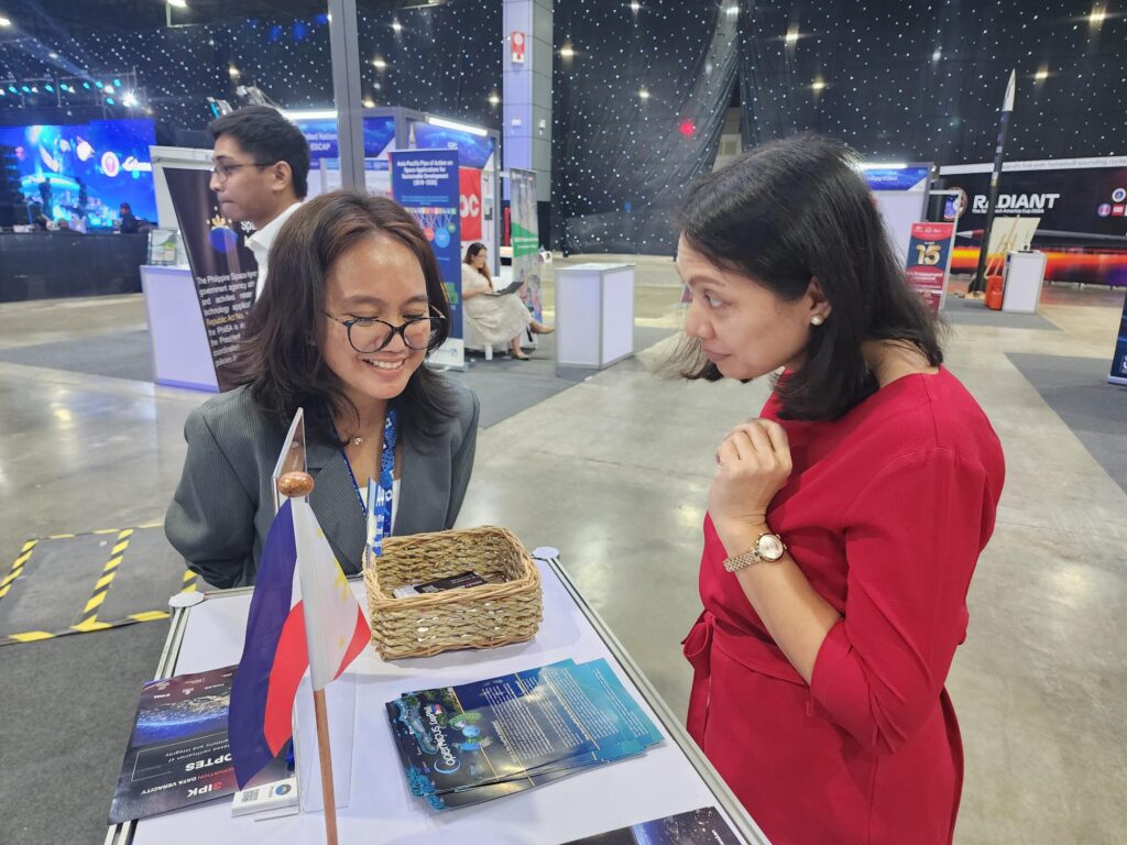
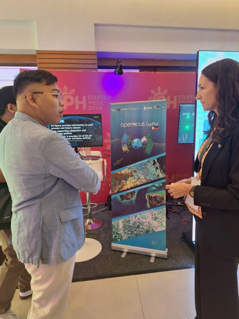
From top to bottom: Philippine Space Week, Thailand Space Week, Philippine Startup Week
Looking Ahead to 2025
Building on these achievements, the CopPhil initiative is looking forward to continuing its mission of making Copernicus data more accessible to users in the Philippines. The upcoming year holds exciting developments in store, including new training sessions, stakeholder engagements, and the continued development and validation of the pilot services.
Background Information
As a flagship and unique programme of the EU’s Global Gateway strategy, CopPhil is designed to harness digital resources and space technology for sustainable development and to support innovations in research and business in close cooperation with government partners.
CopPhil is managed by the European Union Delegation to the Philippines. It is implemented by the European Space Agency (ESA) in partnership with the Philippine Space Agency (PhilSA) and the Philippine Department of Science and Technology (DOST).


